

Modern navigation has undergone a major technological revolution with the arrival of maritime geolocation. This system, which makes it possible to accurately determine the position of a ship in real time, has become an essential pillar of global maritime activity. Whether they are commercial vessels transporting goods between continents, fishing boats exploiting ocean resources, or boaters cruising the coasts, everyone is now benefiting from this technology. Maritime geolocation meets multiple and interconnected challenges: it considerably reinforces safety at sea by making it possible to avoid collisions and react quickly to emergency situations, it improves the operational efficiency of fleets by optimizing maritime routes, it generates substantial fuel savings, and it contributes to the protection of the marine environment by allowing better control of activities. This article proposes to explore in depth this technology that has become indispensable: we will begin by understanding how it works and its technical components, then we will analyze its numerous advantages before examining its current limits and the prospects for evolution that are emerging in the future.
Understanding maritime geolocation
What is maritime geolocation?
Maritime geolocation refers to all the technologies and systems that make it possible to determine, track and communicate the geographical position of a ship on oceans and waterways. Unlike terrestrial geolocation, which can rely on dense mobile antenna networks and developed ground infrastructure, geolocation at sea must deal with the vastness of maritime spaces and the absence of terrestrial relays. It is mainly based on satellite systems capable of covering ocean areas far from any coast.
The fundamental principle remains similar to that used on Earth: satellites emit signals that the embedded receivers capture to calculate their position by triangulation. However, the maritime environment imposes specific constraints. Ships need to know not only their own position, but also that of other surrounding buildings to avoid the risk of collision. This is why maritime systems integrate communication and information exchange functionalities between ships.
Modern hybrid systems combine several complementary technologies to ensure maximum reliability. This redundancy is essential because a failure in the navigation system can have dramatic consequences in the open sea, where visual references are absent and the weather conditions are sometimes extreme.
Technologies at the heart of the system
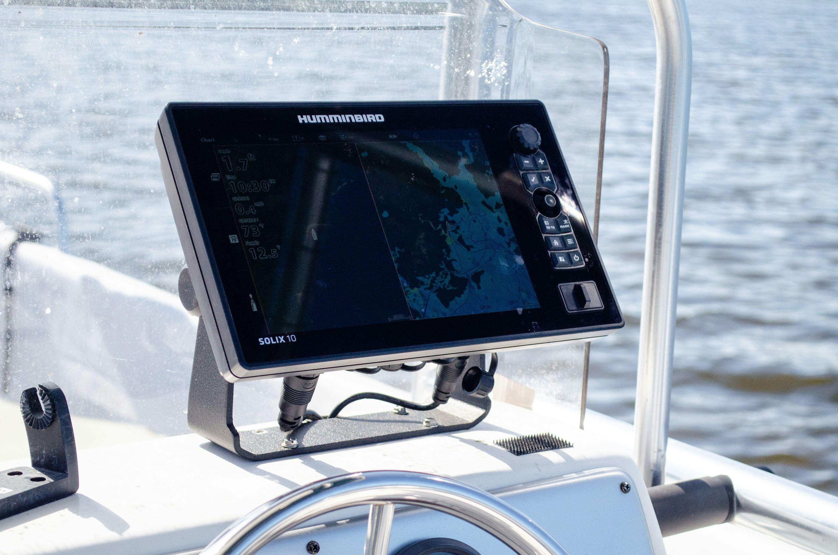
The AIS, or Automatic Identification System, is a cornerstone of modern maritime geolocation. This automatic system allows ships to send and receive essential information such as their identity, position, heading, speed, and dimensions. Mandatory for all commercial vessels over 300 tons and for all passenger ships, AIS operates on specific maritime radio frequencies and allows direct communication between vessels, without going through a satellite intermediary. AIS data is also captured by specialized coastal stations and satellites, allowing global monitoring of maritime traffic.
GPS and GNSS systems, an acronym for Global Navigation Satellite Systems, represent the technological basis for satellite positioning. The American GPS was the first operational system, but it is now complemented by other constellations such as the European Galileo system, the Russian GLONASS and the Chinese BeiDou. These systems work according to the same principle: a constellation of satellites in orbit emits very precise time signals, and the receiver calculates its position by measuring the travel time of these signals from several satellites. The combined use of multiple GNSS systems greatly improves location accuracy and reliability.
Auxiliary systems such as marine radar and VHF radio communications complete this system. Radar makes it possible to detect other vessels and obstacles even in poor visibility, while VHF radios are used for voice communications and the exchange of safety information. Emerging technologies such as maritime IoT boxes, such as those offered by Oria Marine, bring an additional dimension by connecting various embedded sensors for even more complete and intelligent monitoring of the ship.
The actors and infrastructures involved
The maritime geolocation ecosystem mobilizes a multitude of actors with complementary roles. National and international maritime authorities, such as the International Maritime Organization, establish the standards and regulations that govern the use of these technologies. In particular, they require mandatory equipment in AIS and GPS systems for certain categories of vessels and supervise compliance with navigation rules.
Shipowners and shipping companies are the main users of these systems on a commercial scale. They invest in sophisticated equipment and fleet management platforms to optimize their operations. For these actors, geolocation is not only a security tool, but a real driver of economic performance, making it possible to monitor dozens or hundreds of ships simultaneously, to anticipate port arrivals and to coordinate logistics operations.
Boaters represent a growing segment of users, with often different needs and resources. While professional systems can cost several thousand euros, more accessible solutions are being developed for recreational navigation, ranging from portable GPS to mobile applications to individual distress beacons.
The technical infrastructure is based on satellite operators who maintain and develop GNSS constellations, as well as on online tracking platforms such as MarineTraffic or VesselFinder. These services collect AIS data issued by ships and make it available to the public, allowing anyone to monitor global maritime traffic in real time. This unprecedented transparency is profoundly transforming ocean governance.
The advantages of maritime geolocation
Increased safety at sea
The contribution of geolocation to maritime safety is undoubtedly its most fundamental benefit. Before the advent of these technologies, ships navigated with limited means of location, relying on astronomical navigation and complex calculations. Collisions at sea, which were particularly frequent in areas with heavy traffic or poor visibility, regularly caused considerable human and material losses.
Today, thanks to AIS and electronic chart visualization systems, watch officers can see in real time the position, course, and speed of all surrounding vessels over a radius of several tens of kilometers. This situational awareness makes it possible to anticipate dangerous situations and to take avoidance measures well before a real risk materializes. Modern systems even incorporate automatic alert functions that alert the crew when another ship is on a potential collision course.
The management of emergency situations has also been transformed by geolocation. When a ship issues a distress signal, its exact position is immediately known to emergency services, significantly reducing reaction time and increasing the chances of rescue. Modern emergency beacons, whether mounted on the ship or carried individually, automatically transmit their position via satellite as soon as they are activated. This ability to precisely locate a ship in difficulty, even in the middle of the ocean, has saved countless lives.
A performance and efficiency tool
Beyond safety, maritime geolocation has emerged as a great tool for economic and operational optimization. Real-time logistics monitoring allows shipowners and shippers to know the exact position of their goods at any time, to accurately estimate delivery times and to coordinate port operations effectively. This visibility throughout the supply chain reduces uncertainty, improves planning, and allows for better use of resources.
The optimization of maritime routes is another major economic advantage. By analyzing geolocation data combined with weather forecasts and marine currents, modern systems can calculate the most efficient trajectories. These optimized roads make it possible to significantly reduce the distances traveled, to avoid areas of bad weather and to take advantage of favorable currents. The savings generated are considerable, both in terms of sailing time and fuel consumption.
Reducing fuel costs deserves particular attention as it represents a major expense item for any maritime activity. Even modest optimization of routes can generate savings of several percentages on total consumption, which translates into millions of euros in savings for major shipping companies. These financial gains are accompanied by a direct environmental benefit since less fuel burned means fewer emissions of greenhouse gases and air pollutants.
Transparency and traceability
Maritime geolocation has introduced an unprecedented level of transparency in a traditionally opaque field. Tracking cargo from the port of origin to the port of destination allows not only better logistics management, but also full traceability that strengthens customer confidence and facilitates insurance operations. This transparency is particularly valuable for sensitive or high-value goods, where precise knowledge of the location and conditions of transport is an essential element.
The fight against illegal, unreported and unregulated fishing is an area where geolocation has proven to be effective. Fishing vessels equipped with tracking systems can be monitored by the authorities to verify that they comply with authorized areas and assigned quotas. This surveillance makes it possible to better protect overexploited fish stocks and to maintain the balance of marine ecosystems. Attempts to deactivate AIS systems by ships seeking to operate illegally are now detectable by surveillance platforms that identify these suspicious behaviors.
The contribution to the protection of the marine environment goes beyond the issue of fishing alone. Geolocation makes it possible to monitor compliance with environmental protection zones, to detect pollution at sea by correlating oil slicks observed by satellite with the trajectories of ships, and to verify compliance with emission standards in emission control areas. This surveillance capacity reinforces the application of environmental regulations and encourages responsible behavior.
The limits and challenges of maritime geolocation
Technical constraints
Despite its many advantages, maritime geolocation faces significant technical limitations that restrict its effectiveness in certain situations. White areas, where satellite coverage is non-existent or insufficient, are a first challenge. Although GNSS systems theoretically offer global coverage, some polar or particularly remote regions may experience signal disturbances. Even more problematic, AIS systems rely on terrestrial or satellite relays to transmit data beyond their direct radio range, and this collection infrastructure has shortcomings in some remote ocean areas.
Dependency on external systems is a major vulnerability. A modern ship may have sophisticated equipment, but all remain dependent on the satellite signals they receive. A failure in the satellite constellation, although rare, would have potentially catastrophic consequences for global maritime traffic. Interference, whether natural, such as solar storms, or intentional, such as signal jamming, can disrupt or render navigation systems unusable.
Cybersecurity issues are taking on a particularly critical dimension in the maritime field. Modern navigation and geolocation systems, which are increasingly connected and computerized, are becoming potential targets for cyberattacks. Incidents have already shown that it is possible to falsify GPS signals to deceive receivers and make a ship believe that it is elsewhere than its real position. These spoofing techniques, originally developed for military purposes, could be used by malicious actors to cause accidents or facilitate illegal activities.
Data confidentiality and security issues
The transparency provided by maritime geolocation, while offering numerous advantages, also raises legitimate privacy and security concerns. The risks of hacking or falsifying AIS signals are not purely theoretical. Security researchers have shown that it is possible to emit false AIS signals to create ghost ships on navigation screens, or on the contrary to mask the presence of a real ship. These vulnerabilities could be exploited by hackers looking to identify interesting targets or by criminal organizations that want to hide their activities.
The protection of sensitive data concerning ships and their itineraries is a major strategic and commercial challenge. For military vessels, the disclosure of their position and movements obviously represents a security risk. But even in the civilian field, detailed knowledge of trade routes, ports of call, and the nature of cargo can be of significant value to commercial competitors or of interest to malicious actors. Shipowners must constantly assess the trade-off between the benefits of transparency and the risks associated with exposing their operational information.
The legal framework surrounding the use and protection of this data remains evolving. Public maritime tracking platforms aggregate and disseminate information that, taken individually, is technical navigational data, but that collectively can reveal sensitive information about commercial activities or operational habits. The question of how far transparency should go and how to protect legitimate privacy interests has not yet been definitively and consensually answered.
Economic and regulatory limits
Access to professional maritime geolocation represents a significant financial investment. The costs of installing mandatory equipment, including AIS transponders, differential GPS, radars and electronic mapping systems, can reach several tens of thousands of euros for a commercial vessel. In addition to these initial costs, there are regular maintenance expenses, software updates, and the periodic replacement of obsolete equipment.
These financial constraints create significant inequalities in access between large shipping companies, which have the resources necessary to equip themselves with the most advanced technologies, and small shipowners or boaters who must make do with more basic equipment. This disparity raises questions of equity and safety, as not all users of the sea benefit from the same level of protection and performance. Emerging solutions such as Oria Marine's connected boxes are trying to bridge this gap by offering advanced technologies at more accessible costs for small boats.
The international regulatory framework, although it has evolved considerably to impose equipment standards, still has shortcomings and inconsistencies. Requirements vary depending on the size of the vessels, their area of operation, and national regulations, creating a complex patchwork of rules that can be difficult to navigate, especially for ships making international trips. The harmonization of these regulations is progressing but remains a work in progress, and some maritime areas remain less strictly monitored than others.
Towards a new generation of maritime geolocation
Artificial intelligence and big data at the service of navigation
The evolution of maritime geolocation is now moving towards the integration of artificial intelligence and the massive exploitation of collected data. Predicting optimal roads now goes beyond the simple geometric analysis of current distances and weather conditions. Artificial intelligence systems can analyze years of historical data on currents, winds, fuel consumption, and ship performance to identify complex patterns and suggest routes that would have been impossible to calculate using traditional methods.
Automated fleet management is another promising application of these technologies. By combining geolocation data with information on the condition of ships, current orders, port availability and demand forecasts, intelligent systems can optimize the allocation of ships to different missions in real time. This automated orchestration makes it possible to significantly improve the use of assets and to reduce unproductive downtime.
Environmental monitoring also benefits from these technological advances. Artificial intelligence analysis of geolocation data makes it possible to identify suspicious behavior that may indicate illegal fishing activities, discards at sea or violations of protected areas. These systems can process volumes of data much greater than what a human team could analyze, allowing for much more effective surveillance of vast maritime spaces. Machine learning allows systems to become progressively better at detecting anomalies and distinguishing between normal behavior and suspicious activities.
Future innovations
The technological landscape of maritime geolocation continues to evolve rapidly with the emergence of new satellite constellations. Elon Musk's Starlink Maritime project promises to bring high-speed Internet connectivity everywhere at sea through a constellation of several thousand satellites in low orbit. This infrastructure could radically transform maritime communications and enable navigation and management applications that require massive data exchanges in real time.
The European Galileo system, now fully operational, offers increased accuracy compared to traditional GPS systems and incorporates advanced security features that address concerns about reliability and resistance to interference. The continuous improvement of these GNSS systems, with more robust signals and more sophisticated calculation methods, promises even better performances in the years to come.
The integration of connected objects on board, or maritime IoT, represents a major trend that goes well beyond simple geolocation. Embedded sensors can now monitor a multitude of parameters in real time: fuel consumption, engine status, tank levels, local weather conditions, cargo movement, and more. This data, transmitted via satellite connections and combined with location information, allows predictive maintenance management and continuous optimization of operations. Devices like those from Oria Marine illustrate this convergence between geolocation and intelligent vessel surveillance, offering a global and connected vision of the state and position of the boat.
Conclusion
In a few decades, maritime geolocation has emerged as an absolutely central element of modern navigation, profoundly transforming the way in which we navigate the oceans. The benefits it brings are multiple and considerable: considerably strengthened maritime safety thanks to real-time knowledge of positions and the ability to respond quickly to emergencies, improved operational efficiency by optimizing routes and reducing costs, and new transparency that contributes to the protection of the marine environment and the fight against illegal activities.
However, this technology is not free of limitations and challenges that it would be unwise to ignore. Technical constraints, with imperfect coverage areas and dependence on vulnerable external systems, cybersecurity and data protection challenges, as well as economic disparities in access to these technologies, are all points of attention that require constant vigilance and continuous improvement efforts.
The future of maritime geolocation promises to be rich in innovations, with artificial intelligence, new satellite constellations and the Internet of Maritime Things that promise to push the current limits even further. However, these technological developments must be accompanied by a thorough reflection on their responsible and equitable use. Maritime geolocation has become an indispensable tool, but it does not provide solid nautical training, informed human judgment and constant responsibility in its use. The navigators of today and tomorrow must master these tools while maintaining fundamental navigation skills and remaining aware that technology, however efficient it may be, remains an aid to human decision and cannot be a total substitute for it.
FAQ — Maritime geolocation in questions
What is the difference between AIS and GPS at sea?
GPS and AIS are two complementary but distinct technologies that serve different purposes in marine navigation. GPS, or more broadly GNSS systems, allows a ship to determine its own geographical position by receiving signals sent by satellites. It is a passive positioning system: the ship receives information but does not emit anything. AIS, on the other hand, is an active communication system that allows ships to exchange information about their identity, position, speed, and course with each other. In practice, AIS uses the position data provided by the ship's GPS and broadcasts it via VHF radio to other surrounding buildings. So GPS answers the question “where am I?” , while the AIS answers “where are the other ships around me?” The two systems work together to create a complete picture of the maritime situation.
Can you geolocate a boat without an Internet connection?
Yes, the geolocation of a boat works perfectly without an Internet connection. GPS and GNSS systems receive signals directly from positioning satellites and calculate the ship's position independently, without requiring any Internet connection. Likewise, AIS communicates via dedicated maritime radio frequencies and does not depend on the Internet. A ship equipped with a GPS and an AIS transponder can therefore know its position and share it with surrounding buildings even in the middle of the ocean, far from any terrestrial network coverage. On the other hand, some advanced functionalities such as tracking the ship from land via platforms such as MarineTraffic, receiving up-to-date weather reports or using certain mobile applications actually require an Internet connection, generally provided by satellite links in remote areas.
Is geolocation data available to the general public?
Maritime geolocation data is partially accessible to the public, but in varying ways. AIS information from commercial vessels is captured by coastal stations and satellites and then broadcast on online platforms such as MarineTraffic, VesselFinder, or Fleetmon. These services allow anyone to track the movements of most commercial vessels in real time, with information about their identity, position, speed, destination, and route history. This transparency mainly applies to commercial vessels and professional fishing vessels that are legally required to emit AIS signals. In contrast, military vessels and many small pleasure craft are not equipped with AIS or may choose not to broadcast it, thus protecting their privacy. Some platforms also offer paid services with more detailed data, longer histories, and advanced analytics features for marine professionals.
How does geolocation contribute to maritime safety?
Geolocation is a fundamental pillar of modern maritime security by intervening at several critical levels. First, it helps avoid collisions by providing crews with complete situational awareness: thanks to AIS and GPS data displayed on electronic mapping systems, navigators see the position, speed, and heading of all surrounding vessels in real time, allowing them to anticipate dangerous situations and take avoidance measures well before an immediate risk arises. Second, in case of emergency, geolocation saves lives by allowing immediate and accurate location of vessels in distress. When an SOS signal is issued, emergency services instantly know the exact position of the disaster, drastically reducing the time needed to provide assistance. Modern emergency beacons automatically transmit GPS coordinates as soon as they are activated, even if the crew is unable to communicate by radio. Third, geolocation contributes to safety by allowing better road planning that avoid dangerous areas, shoals, bad weather areas, and high-traffic regions, thereby reducing risk exposure.
What are the coverage limits of geolocation systems?
Although maritime geolocation systems theoretically offer global coverage, several practical limitations reduce their effectiveness in certain areas and situations. GNSS systems such as GPS have fairly reliable global coverage, but may experience signal degradation in extreme polar regions where the angle of elevation of satellites is very low, or in certain exceptional atmospheric conditions. More significantly, AIS systems have significant coverage gaps. The direct radio range of AIS between ships typically extends to a few tens of kilometers depending on conditions, which works well in coastal and high-traffic areas. However, in the middle of the ocean, far from terrestrial receiving stations, only satellites equipped with AIS receivers can pick up signals, and this AIS satellite coverage remains incomplete with areas and periods where data is not collected. Isolated ocean regions such as the South Pacific or certain areas of the Indian Ocean may thus have shortcomings in AIS tracking, creating “white zones” where vessel movements are not monitored in real time. These limitations explain why professional marine navigation still requires redundant systems and the maintenance of traditional navigation skills.
What online tracking tools are the most reliable for boaters?
For boaters wishing to follow maritime traffic or to be followed during their navigation, several online platforms stand out for their reliability and functionalities. MarineTraffic remains the global reference with the most extensive coverage and an intuitive interface that allows you to visualize in real time the positions of vessels, their characteristics and their route histories. The free version already offers substantial features, while paid plans provide more detailed data and customizable alerts. VesselFinder is a popular alternative with a clear graphical layout and comparable maritime traffic information. For boaters equipped with AIS transponders, these platforms also make it possible to make their own ship visible and to share their position with loved ones. Beyond these visualization platforms, more specialized solutions for boaters exist, such as the Oria Marine system, which combines geolocation and intelligent boat monitoring. These connected devices not only allow you to track the position of the boat from a smartphone, but also to monitor various parameters such as battery status, intrusions or unusual movements, thus offering significant peace of mind when the boat is at anchor or in port. The choice of the tool ultimately depends on specific needs: simple consultation of maritime traffic, sharing one's own position, or complete surveillance of one's boat.


